December 11, 2019 report
Sonar study shows crater made by underwater Bikini atoll A-bomb test

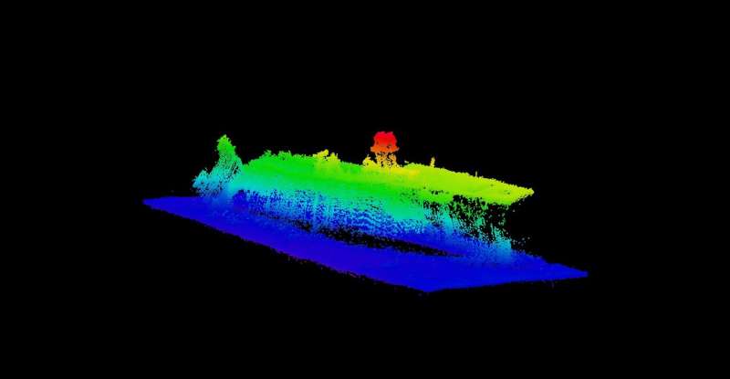
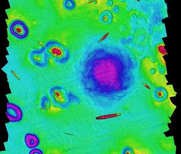
A team of researchers from the University of Delaware has mapped the seafloor where an atomic blast created a crater back in 1946 during a test. The team has given a presentation outlining their findings at this year's fall meeting of the American Geophysical Union. Using high-resolution sonar, the team created depth maps that showed not only the crater created by the blast but the test ships that were used to measure its power.
The researchers began their report by noting that the U.S. carried out 22 atomic bomb tests in and around the bikini atoll over the years 1946 to 1958. In this new effort, they attempted to map two of the atomic test sites called Able and Baker (which were part of Operation Crossroads), both offshore. The bombs were detonated underwater to learn more about their destructiveness in such an environment. Prior to detonation, captured German and Japanese ships were placed in the vicinity to see what the bomb would do to them. They described the area as "the world's first simulated nuclear battlefield." They further reported that they were unable to find any seabed evidence of the Able test, but were able to map the area where the Baker test was carried out.
The Baker test involved exploding a 21-kiloton bomb 27 meters below the surface of the ocean. The blast, which was filmed and shown around the world, blew 2 million tons of water and seafloor material into the air and formed the characteristic mushroom cloud. The researchers noted that they did not expect to find a crater, believing natural ocean sediment flow would have filled it in by now. But that was not the case, as could be seen in the images they captured. A crater was clearly visible, surrounded by several sunken ships. Measurement of the crater showed it to be approximately 700 meters across and 8 meters deep. They noted also that the crater had a rippled appearance at its edges, appearing similar in outline to a rose. They explained that the rippling was likely due to some of the impact material settling back down in the seabed. They also reported that they had found bedform features radiating from the crater. They suggested such features came about due to a series of waves created by the blast—they were found to have wavelengths of 30 to 75 meters and amplitudes of approximately 1 meter.

More information: OS13C-1559 - Atomic Bombs at Bikini- Seafloor Mapping of the Nuclear Battlefield of Operation Crossroads and Castle Bravo Craters, agu.confex.com/agu/fm19/meetin … app.cgi/Paper/580698
© 2019 Science X Network


