NASA sees Atlantic subtropical storm Melissa form off New England coast

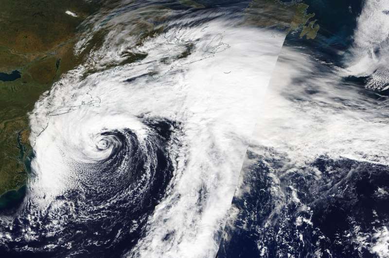
Satellite data has confirmed the formation of Subtropical Storm Melissa. NASA's Terra Satellite provided a visible image the former Nor'easter turned subtropical storm off the coast of New England.
The National Hurricane Center or NHC noted that the Nor'easter centered southeast of New England (in the northeastern U.S.) becomes a subtropical storm, and that the change in storm status does not change expected impacts from wind and coastal flooding along portions of the mid-Atlantic coast and Southeastern New England.
On Oct. 11, the Moderate Imaging Spectroradiometer or MODIS instrument that flies aboard NASA's Terra satellite provided a visible image of the newly developed Melissa. Forecasters at the National Hurricane Center noted on Oct.11 at 11 a.m. EDT, "Convection increased near the center of the nor'easter centered southeast of New England overnight. First-light visible satellite imagery briefly showed an eye-like feature before the convection around the immediate center began to weaken. However, a large convective band still persists over the northern semicircle, and this structure indicated the system has transitioned to a subtropical cyclone."
At 11 a.m. EDT (1500 UTC), on Oct. 11, the center of Subtropical Storm Melissa was located near latitude 38.5 degrees North and longitude degrees 69.6 West. That is about 190 miles (300 km) south of Nantucket, Massachusetts. Melissa is moving toward the south-southwest near 3 mph (6 kph), but little net motion is expected today. A turn toward the east-northeast with an increase in forward speed is forecast tonight and this motion will continue through the weekend. On the forecast track, the center of Melissa will move away from the east coast of the United States.
Maximum sustained winds are near 65 mph (100 kph) with higher gusts. Gradual weakening is expected over the next couple of days, and Melissa is forecast to lose its subtropical characteristics by Saturday night. Winds of 40 mph extend outward up to 345 miles (555 km) from the center, primarily over waters. The estimated minimum central pressure is 995 millibars.
Hurricanes are the most powerful weather event on Earth. NASA's expertise in space and scientific exploration contributes to essential services provided to the American people by other federal agencies, such as hurricane weather forecasting.
Provided by NASA's Goddard Space Flight Center


