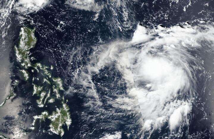
NASA-NOAA satellite sees Tropical Depression 19W organizing

NASA-NOAA's Suomi NPP satellite passed over the Northwestern Pacific Ocean and provided forecasters at the Joint Typhoon Warning Center with a view of Tropical Depression 19W's structure that helped confirm it is now a depression.
On Sept. 27, 2019, the Visible Infrared Imaging Radiometer Suite (VIIRS) instrument aboard Suomi NPP provided a visible image of newly developed Tropical Depression 19W. The VIIRS image showed the storm had already developed some strong thunderstorms around its center with a band of strong storms feeding into the center from the southeast. The VIIRS imagery helped confirm that the storm is now a depression and appears to be strengthening toward tropical storm status.
On Sept. 27 at 5 a.m. EDT (0900 UTC), Tropical Depression 19W had maximum sustained winds near 25 knots (29 mph)/46 kph). 19W was centered near 14.4 degrees north latitude and 136.2 degrees east longitude. That puts the center approximately 908 nautical miles southeast of Kadena Air Base, Okinawa Island, Japan. The storm was moving to the west.
Forecasters at the Joint Typhoon Warning Center expect 19W will move west-northwest and strengthen, then turn north and move east of Taiwan.
Provided by NASA's Goddard Space Flight Center


