Scientists map 'deepest' parts of Southern Ocean

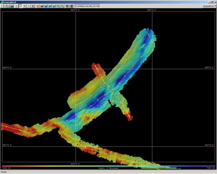
A team of researchers led by British Antarctic Survey has for the first time mapped the deepest part of the South Sandwich Trench in the Southern Ocean. This part of the ocean is more than seven kilometres deep in places and could reveal how the densest water in the ocean is changing.
The team on the RRS James Clark Ross is looking at the physics and biogeochemistry of how the ocean mixing and currents behave between the Antarctic Peninsula and the South Scotia Ridge. They have undertaken the first comprehensive swath mapping of the southern part of the South Sandwich Trench, which could hide significant new insights into Antarctic Bottom Water production and evolution, acting as a sort of time capsule for old water.
The research cruise called ANDREX II (Antarctic Deep-Water Rates of Export) is part of the ORCHESTRA programme. Data is being collected by mapping of the sea floor and water sampling using a CTD.
The aim of the cruise, aside from mapping an interesting and previously unexplored part of the ocean, is that the very deep holes may act as oceanographic time capsules. This trench is directly in the outflow path of the deepest and densest bottom waters from the Weddell Sea. The dense bottom water will fall into the holes, but then be trapped and unable to rise up again. These are of great interest as they are comparatively young waters that fill up the deepest parts of the global ocean, trapping heat and carbon for immense periods. Effectively they act to renew the deep ocean and at least partially drive the ocean overturning circulation that mediates global climate.
In recent years many observations, including by BAS, have observed that this deep water is getting less dense, fresher and less voluminous. The reasons are unclear, but are likely to at least partially involve climate driven increases in freshwater melt from continental ice. If the newly arriving bottom water has been getting less dense for a long time, it will increasingly not be able to displace the older, denser water trapped in the deep holes of the trench and will instead ride over the top. By sampling the deepest holes we will be able to date the water within. If it is significantly older than the water presently flowing out of the Weddell Sea (which ANDREXII is also measuring), that suggests there has been a lightening trend and gives a minimum bound on how long it has been going on for.
Such deep trapped water masses also give us information about vertical mixing rates, an important but very poorly understood and measured metric. This is something that climate models presently do poorly and need more observations to improve.
Provided by British Antarctic Survey


