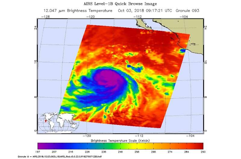
NASA takes powerful Hurricane Sergio's temperature

Infrared light provides scientists with temperature data and that's important when trying to understand the strength of storms. NASA's Aqua satellite provided those cloud top temperatures of Category 4 Hurricane Sergio in the Eastern Pacific Ocean.
The Atmospheric Infrared Sounder or AIRS instrument aboard NASA's Aqua satellite passed over Hurricane Sergio on Oct. 3 at 5:17 a.m. EDT (0917 UTC) and analyzed the storm in infrared light. The higher the cloud tops, the colder and the stronger the storms. Infrared light as that gathered by the AIRS instrument can identify the strongest sides of a tropical cyclone.
AIRS temperature data showed Sergio had intensified that morning, with the eye becoming better defined while embedded in very cold cloud tops. AIRS detected those very cold cloud tops were as cold as or colder than 207 Kelvin (minus 87 degrees Fahrenheit/minus 66.1 degrees Celsius). Storms with cloud top temperatures that cold have the capability to produce heavy rainfall.
At 5 a.m. EDT (0900 UTC) on Thursday, Oct. 4 the National Hurricane Center or NHC noted "Sergio's intensity is estimated to have increased just a little more this morning, and it remains a powerful category 4 hurricane."
The eye of Hurricane Sergio was located near latitude 14.4 degrees north, longitude 118.8 degrees west. That's about 825 miles (1,330 km) southwest of the southern tip of Baja California, Mexico. Sergio was moving toward the northwest near 8 mph (13 km/h), and this motion is expected to continue today. A turn toward the west-northwest and west at a slightly slower forward speed is expected Friday and Saturday.
Maximum sustained winds are near 140 mph (220 kph) with higher gusts. Sergio is a category 4 hurricane on the Saffir-Simpson Hurricane Wind Scale.
Provided by NASA's Goddard Space Flight Center


