Bali's Agung – using 'volcano forensics' to map the past, and predict the future

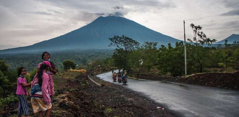
Mount Agung, known locally as Gunung Agung, is a 3,142 metre high volcano located at the eastern end of the island of Bali, Indonesia.
It's erupting ash and steam right now, and has been since Saturday November 25, 2017.
To work out what might happen next at Agung, scientists rely on current observations, paired with forensic techniques that tease apart the geology of this volcano.
Signs that might indicate onset of a more dangerous eruption at Agung are:
- intensifying emissions of ash that reach the stratosphere (the second layer of the Earth's atmosphere)
- lava flows starting to descend the mountain's flanks
- sustained shaking of the volcano by earthquakes.
On everyone's mind is Agung's most recent large eruption in 1963-64. At this time, more than 1,000 people were killed by dense flows of hot volcanic rocks and dust (called pyroclast density flows), and mudflows of volcanic debris called lahars.
Recent activity at Mount Agung
Through September and October this year, a large number of earthquakes were detected below Mount Agung.
A 10 km evacuation zone was established, and about 100,000 persons moved to safer accommodation. The seismicity declined, and a steady plume of steam emerged from the summit crater. This indicated that groundwater was being heated by magma (a hot mixture of molten and semi-molten rock).
A "phreatomagmatic eruption" – resulting from interaction between magma and groundwater – occurred a few days ago. This was followed by an intensifying eruption of a column of ash, reaching some 8 km into the atmosphere. This style of eruption is called "plinian" after the climactic eruption of Vesuvius in 79AD, as described by Pliny the Younger.
The ash is fragmented magma, blown apart by separation and expansion of minerals and gases (water, carbon dioxide and sulfur dioxide) previously dissolved in the magma.
Now earthquake activity has picked up again. "Harmonic tremors" are occurring, where the volcano shakes due to magma moving rapidly through underground channels and fractures that are connected to the summit crater.
Evacuations are active again, given concern that the eruption might escalate further. Dangerous pyroclast density flows – a style known as "peléean" after the 1902 eruption of Mt Pelée in the Lesser Antilles – are possible.
Volcano forensics at Agung
Studies of previous eruptions of volcanoes are critical in attempting any kind of prediction for future behaviour.
In the case of Mount Agung, mapping of the ashes, mudflows, pyroclast density flows, and lavas for eruptions that dated back about 5,000 years were reported in a 2015 study.

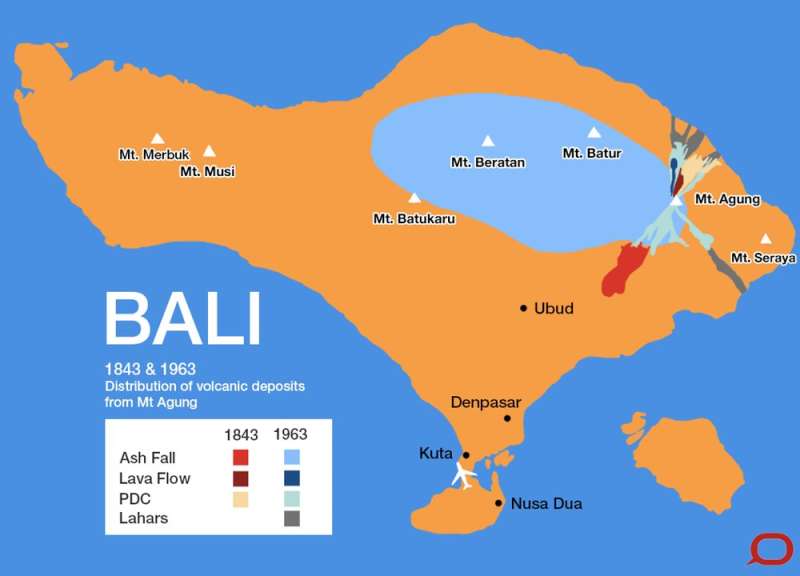
Measurements to determine the frequency of eruptions, plus the area and thicknesses of the various types of flow and ash deposits were made. The map shows some of these features for the eruptions in 1963 and 1843.
The authors concluded that the eruption of Agung in 1843 was more energetic than that of 1963-64, and eruptive activity in the past few hundred years has been more intense on average than its behaviour for the past few thousand years.
Volcanic Explosivity Index
Accompanying the basic field mapping, a variety of other forensic methods are used by geologists to map out past volcanic activity.
A "Volcanic Explosivity Index" is a measure calculated based on direct observations of eruptions, plus experimental replication and modelling. It reflects the intensity and explosivity of a given eruption, factoring in how high, how much, how widespread, how hot, and how dangerous (in terms of gas output) the emitted materials were.
Follow up analyses take place in the lab. Scientists work on volcanic rocks and other materials to determine what materials they are made of, their chemical compositions and the makeup of any trapped gases.
One important goal is to work out the viscosity (the "runniness") of the magma that was present at the site. Magmas that contain high levels of silica – an example is rhyolite – tend to be more viscous, and therefore more likely to be explosive than less silica-rich types, such as basalt and andesite.

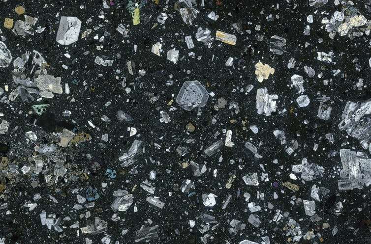
Rocks that are recovered from a volcanic site carry a physical and chemical record of the underground conditions they had been exposed to in the past. The record is seen in the layers, or zones, of crystalline minerals that make up volcanic rocks.
For Mount Agung, this type of forensic work has been very useful. It shows that recharging of a magma chamber in the Earth's crust – that is, arrival of a new batch of magma from deeper levels in the crust into the shallowest magma chamber that feeds the summit eruption – had preceded and probably triggered the 1963-64 eruption.
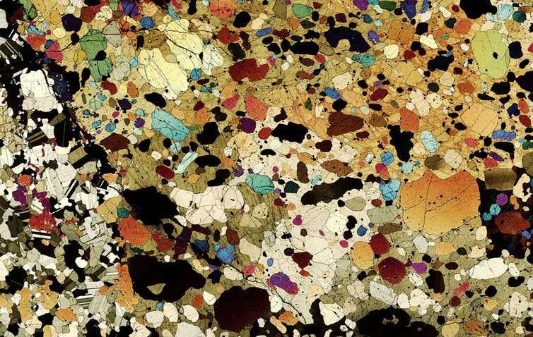
Some volcanic rocks are incredibly beautiful. Fragments of magma that have cooled within the Earth's crust result in coarsely crystalline rocks, as shown in the photograph below.
Watching and waiting
There remain many uncertainties in terms of predicting where, when, and how energetic the next eruption will be for many of the many volcanoes on Earth.
In the case of Mount Agung, current measurements plus past "form" are currently being applied to monitor the situation.
For many volcanoes however, we have not established patterns because the gaps between eruptions are so long. Other factors can be hard to predict, like the structural collapse that occurred at Mt St Helens in 1980.

The volcanoes with the longest known breaks between eruptions have erupted the largest volumes of material. These are the so-called "super volcanoes", such as those at lakes Taupo (New Zealand) and Toba (Sumatra, Indonesia).
There are no observations recorded by humans for these enormous events, and volcano forensics are currently our only guides as to their possible behaviour.
In Bali, experts are watching closely for more ash, and evidence of lava flows that might herald high danger for locals.
Provided by The Conversation


