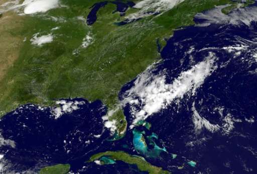
Atlantic hurricane season could be 'extremely active': NOAA

The Atlantic Ocean now faces a higher likelihood of an "extremely active" hurricane season with more storms than previously predicted, US forecasters warned Wednesday, updating the previous outlook issued in May.
Already, six storms large enough to merit their own names have roiled the Atlantic, just one indicator of a stormier than anticipated season ahead, said the National Oceanic and Atmospheric Administration (NOAA).
These six make up "half the number of storms during an average six-month season and double the number of storms that would typically form by early August," said the US government agency in a statement.
"The season has the potential to be extremely active, and could be the most active since 2010."
Between 14 and 19 big storms—ranging from tropical storms to powerful hurricanes—are now expected for the Atlantic, up from 11 to 17 predicted in the May outlook.
Five to nine of those could be hurricanes, and two to five of those could be major hurricanes.
A major hurricane means Category 3 or higher with wind speeds of 111-129 miles per hour (178-208 kilometers per hour).
Previously, NOAA said there would be two to four major hurricanes this season, and five to nine hurricanes overall.
The Atlantic storm season spans from June to November. Historically, the peak comes between August and October.
Forecasters now say there is a 60 percent chance of an above-normal season.
In May, they predicted a 45 percent chance of an above normal season.
Reasons for the unusually active season include the temperature of the tropical Atlantic.
The waters are "much warmer than average, about one to two degrees Fahrenheit warmer than average, and there is high confidence that this warmth will persist," said Gerry Bell, NOAA's lead hurricane season forecaster, during a conference call with reporters.
Also, there is significantly less likelihood that the weather phenomenon known as El Nino will form.
El Nino is an ocean warming trend that typically reduces hurricanes in the Atlantic, Gulf of Mexico and Caribbean Sea but boosts storms in the eastern Pacific.
Another factor is the wind.
"Wind patterns that are conducive to storm development are now in place across the tropical Atlantic," Bell said.
These include weaker vertical wind shear, tradewinds and easterly wind patters coming off the west coast of Africa, he said.
All the available prediction models are pointing to a more active season than they did in May, Bell added, urging people in the region to prepare emergency kits and supplies.
The first hurricane of the season could be Franklin.
Currently a tropical storm, Franklin is predicted to reach hurricane strength later Wednesday or early Thursday when it makes landfall in Mexico.
© 2017 AFP


