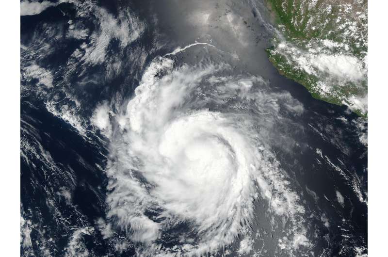
NASA eyes compact Hurricane Hilary

When the NASA-NOAA Suomi NPP satellite passed over the Eastern Pacific Ocean on July 25 it captured a visible close-up of Hurricane Hilary.
The Visible Infrared Imaging Radiometer Suite (VIIRS) instrument aboard the NASA-NOAA Suomi NPP satellite captured a visible light image of Hilaryon July 25 at 5:54 p.m. EDT (2154 UTC). The Suomi NPP image showed that Hilary appeared somewhat asymmetric.
The National Hurricane Center (NHC) noted an eye feature in the northwestern portion of the central dense overcast, suggestive of some northwesterly shear.
On July 26, NHC forecaster Blake said "The central dense overcast has become more symmetric, although convection is still preferentially forming in the eastern eyewall. Any eye feature, however, is somewhat less distinct than a few hours ago, and the latest microwave passes are again showing an open eyewall on the west side."
Hilary remains a compact hurricane. Hurricane-force winds extend outward up to 15 miles (30 km) from the center and tropical-storm-force winds extend outward up to 90 miles (150 km). Of the three Eastern Pacific Ocean tropical cyclones: Greg, Irwin and Hilary, Hilary is closest to land, but it's not close enough for coastal watches or warnings.
At 11 a.m. EDT (1500 UTC), the center of Hurricane Hilary was located near 16.4 degrees north latitude and 112.3 degrees west longitude. That's about 475 miles (765 km) south-southwest of the southern tip of Baja California, Mexico. Hilary was moving toward the west near 13 mph (20 km/h), and NHC noted that this general motion with some decrease in forward speed is expected over the next couple of days. Maximum sustained winds remain near 105 mph (165 kph) with higher gusts. Some slow weakening is forecast during the next 48 hours.
Provided by NASA's Goddard Space Flight Center


