LunaH-map cubeSat to map the moon's water deposits

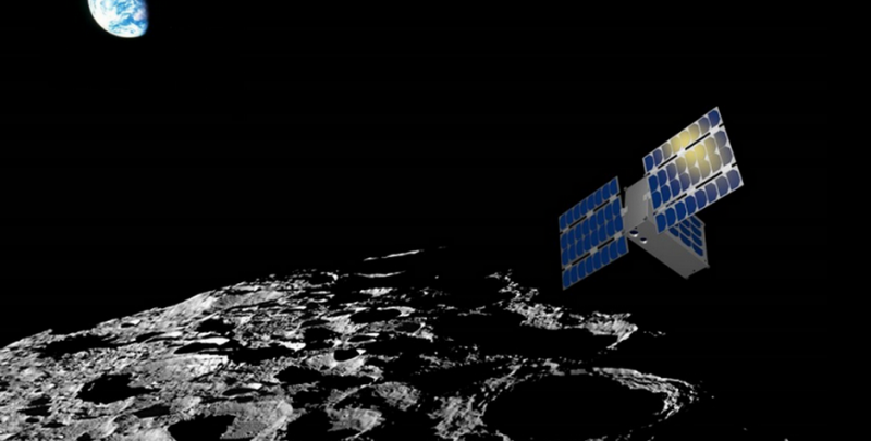
Arizona State University (ASU) is developing a small satellite that will search hydrogen in lunar craters with the ultimate goal of creating the most detailed map of the moon's water deposits. The spacecraft, named Lunar Polar Hydrogen Mapper (LunaH-Map), is expected to shed new light on the depth and distribution of water ice on the moon.
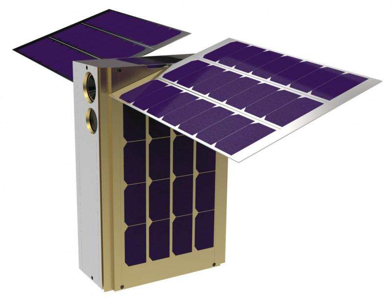
LunaH-Map is a six-unit CubeSat with dimensions of 3.9 × 7.9 × 11.8 inches (10 × 20 × 30 centimeters) and a mass of about 30 lbs. (14 kilograms). The shoebox-sized satellite is planned to be launched in September 2018 as part of NASA's Exploration Mission 1 (EM-1) that will send an uncrewed Orion spacecraft on a trip around the moon. The CubeSat will be inserted into a highly elliptical, low-perilune (3.1 to 6.2 miles, or 5 to 10 kilometers) orbit centered around the South Pole of the moon.
The orbiter will spend about 60 days conducting research, completing 141 science orbits. Although LunaH-Map is smaller than typical NASA missions and is cheaper than previous probes send to the moon, expectations are very high for this university-built spacecraft.
"LunaH-Map has the potential to return high resolution maps of neutron counts over the south pole of the moon, revealing any significant enrichments in water ice within permanently shadowed regions. These maps could be used to better understand the sources and sinks for volatiles in our solar system, as well as for determining future landing locations for rovers or even humans," Craig Hardgrove, LunaH-Map Principal Investigator at ASU's School of Earth and Space Exploration told Astrowatch.net.
In order to successfully map water deposits on the moon, LunaH-Map will utilize its two identical neutron spectrometers consisting of an array of eight elpasolite (Cs2YLiCl6:Ce or CLYC) scintillators each. One array is about two centimeters thick and has a volume of approximately 100 square centimeters.
The spectrometers will map the distribution of hydrogen at a spatial scale equal to approximately one and a half times the orbital altitude. The instruments will map hydrogen within permanently shadowed craters to determine its spatial distribution; map hydrogen distributions with a maximum depth of one meter as well as map its distribution in other permanently shadowed regions throughout the South Pole. In result, LunaH-Map should produce maps of near-surface hydrogen at unprecedented spatial scales of about 7.5 kilometers/pixel.

"Neutron spectrometers look for depletions in the amount of high energy neutrons leaking from the lunar surface and use that as proxy for how much hydrogen and therefore water ice might be contained in the lunar regolith. The detector uses an array of scintillator crystals that produce a small flash of light when they are hit by a neutron. The energy associated with each flash of light is counted in the detector electronics and can be used to produce a map of neutron count rates over the lunar surface," Hardgrove said.
Given the fact that water ice is enriched at the poles of the moon, particularly within regions that are in permanent shadow, LunaH-Map will fly over several of these regions multiple times from a very low altitude. It will acquire neutron counts that can be related to the abundance of hydrogen within the top meter of the lunar surface. The low altitude (less than 10 kilometers above the surface) will allow the spacecraft to improve upon the maps of permanently shadowed regions by "seeing" any regions within them that are substantially enriched in hydrogen.
The mission team mulls the possibility of equipping the LunaH-Map spacecraft in a small color camera. However, such a color imaging instrument is not necessary for the probe's primary science mission, therefore LunaH-Map's star tracker could be used as a black and white camera.
Besides conducting scientific research, LunaH-Map will also demonstrate several new technologies that could be very useful in future CubeSat deep space missions. It is a highly efficient propulsion system that produces very low thrust which over time can change the spacecraft velocity sufficiently, allowing the spacecraft to achieve lunar orbit. In addition to the ion propulsion system, LunaH-Map will test a new deep-space radio for CubeSats, new solar arrays that provide higher power, a new flight computer and attitude control system, and a new science instrument.
"The demonstrated success of any one of these technologies will be a fantastic achievement for deep space CubeSats," Hardgrove said.
He also underlined the importance of this mission for ASU. Although LunaH-Map is not the first planetary science mission for which ASU has provided instrumentation or science expertise, LunaH-Map is the first full planetary science mission to be led by ASU and the School of Earth and Exploration.
"The School of Earth and Space Exploration brings together scientists and engineers across multiple disciplines, and the selection of LunaH-Map, and more recently Psyche and Lucy, demonstrate that NASA is interested in supporting this model of ground-up, interdisciplinary, development of planetary science missions. The success of all these missions will not only enhance our knowledge of the solar system, but hopefully provide inspiration to Arizona students and excellent opportunities to engage ASU students, faculty and staff in missions of exploration across multiple disciplines," Hardgrove concluded.
On its way towards the launch in September 2018, LunaH-Map has already passed a Preliminary Design Review in August 2016 and is scheduled for a Critical Design Review in May 2017.
Provided by Astrowatch.net


