NASA sees deadly typhoon usagi hit southern China

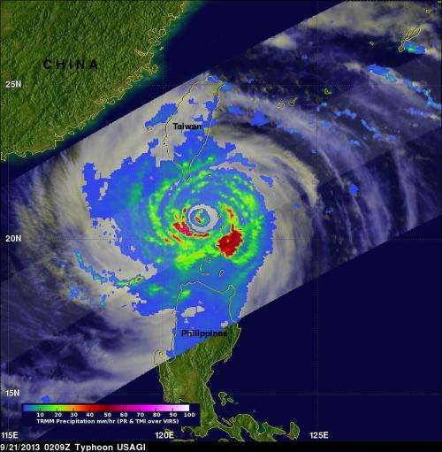
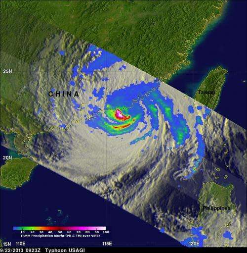
Southeastern China was hit by the most powerful typhoon of 2013 on Sept. 22, when Typhoon Usagi came ashore landfall in the Guangdong Province during the evening. NASA's TRMM satellite observed very heavy rainfall just south of the eye as the center was landfalling.
When Typhoon Usagi, the Japanese word for "rabbit," made landfall it had maximum sustained winds near 95.6 knots (~110 mph). According to Xinhuanet.com news, 25 people were killed by the storm. Over 310,000 residents were displaced due to the storm. Xinhuanet reported economic losses totaled as much as 7.1 billion yuan in Guangdong alone from Usagi.
On Sunday, Sept. 22, at 0900 UTC/5 a.m. EDT, Typhoon Usagi was closing in on the coast of southeastern China where it is poised to make landfall north of Hong Kong. Maximum sustained winds at that time were near 95 knots/109.3 mph/175.9 kph. At that time, the center of this large storm was near 22.6 north and 116.2 east, about 144 nautical miles/165.7 miles/266.7 km east of Hong Kong, but the effects of the storm were already being felt along the coast. Usagi was moving to west-northwest at 12 knots/13.8 mph/22.2 kph and generating very high, rough seas of up to 42 feet/12.8 meters. Coastal areas of southeastern China, and southwestern Taiwan experienced very rough surf as Usagi was making landfall.
Satellite data on Sept. 22 showed that Usagi's eye was about 10 nautical miles wide and beginning to cross the China coast. NASA's TRMM satellite passed overhead on Sept. 22 at 0923 UTC/5:23 a.m. EDT as the storm was making landfall, and TRMM saw very heavy rainfall in the southern quadrant of the storm. There were areas just south of Usagi's eye where rain was falling at a rate of over 169mm/~6.7 inches per hour along China's coast. TRMM radar sliced through Usagi and found that heights of some thunderstorms were reaching only about 12 km /7.4 miles but were returning values of over 54dBZ to TRMM's Precipitation Radar (PR) instrument.

According to CNN early (Eastern Daylight Time) on Sunday, Sept. 22, more than 80,000 people evacuated from the Fujian Province while evacuations also occurred in the Guangdong and Zhejiang provinces.
Xinhuanet reported that about 8,490 houses collapsed and there was damage to about 50,800 hectares of cropland. As Usagi's remnants move over land the rugged terrain north of Hong Kong toward Guangzhou will cause it to dissipate within two days.
Provided by NASA's Goddard Space Flight Center


