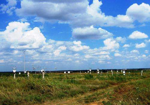
Cotton-ball clouds contained: New modeling method captures clouds' shading effects

(Phys.org)—Small clouds equal big impact. Researchers at Pacific Northwest National Laboratory designed an update to a frequently used computer model that represents the impact of small, puffy, fair-weather clouds on the amount of sunshine reaching Earth's surface. The new method includes variations in temperature and humidity near the surface and their role in forming these small clouds. Their method offers improved climate forecasts and better cloud prediction, including the amount of sunshine the clouds reflect.
Commonly seen clouds over oceans and land look like stretched-out cotton balls. These shallow clouds reflect the sun's energy back to space. Because they are so small, researchers have not been able to track their reflecting properties through global climate models. Improved understanding of the impact of these fair-weather clouds will provide scientists with more detailed information on weather and climate that was frequently misread.
Previously, these clouds were too small to calculate in regional modeling tools.
"Our 'model grid box' is like a large fish net," said PNNL's Dr. Larry Berg, lead scientist. "Previously these puffy, fair-weather clouds, like small fish, fell through the netting and were never caught. With this new method, that is no longer the case."
Researchers first used the Weather Research and Forecasting (WRF) model, a regional model that takes a detailed look at clouds and weather features. Their aim was to calculate the impact of fair-weather clouds, also known as shallow cumulus, on the current model results. After finding that WRF couldn't represent the small clouds, scientists were able to revise the model code to include the missing clouds and their impact. The most substantial change was to replace the default trigger function, an on/off switch used to determine if convective clouds formed, with one that accounts for small changes in temperature and humidity near the surface.
The new method, called the Cumulus Potential (CuP) methodology, was implemented in the WRF to account for all properties of the clouds, including the amount of sunlight reaching the Earth. After incorporating CuP into the WRF model, the team then compared their results to data archived by the U.S. DOE's Atmospheric Radiation Measurement (ARM) Climate Research Facility.
Scientists plan to use the new modified approach to conduct long-term simulations of conditions over the Southern Great Plains and the Tropical Western Pacific Atmospheric Radiation Measurement (ARM) Climate Research Facility sites. These tests will allow researchers to more fully evaluate the performance of the new method and better define the impact of the fair-weather clouds on Earth.
More information: Berg, L., et al. 2012. "Evaluation of a Modified Scheme for Shallow Convection: Implementation of CuP and Case Studies." Monthly Weather Review 141:134-147. DOI:10.1175/MWR-D-12-00136.1
Provided by Pacific Northwest National Laboratory


