NASA gets last looks at former Tropical Storm Darby

Tropical Storm Darby weakened to a remnant low pressure system in the Central Pacific Ocean today, July 26. NASA's Aqua satellite and RapidScat instrument provided a "last look" at Darby when it was still a tropical storm the previous day.
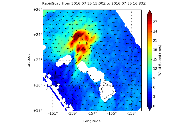
The RapidScat instrument flies aboard the International Space Station and measures winds over an ocean surface. RapidScat provided a look at the winds around Tropical Storm Darby on July 25 as the storm was weakening. RapidScat found strongest wind speeds near 30 meters per second (67 mph/108 kph) north of the center and much weaker around the rest of the elongated storm.
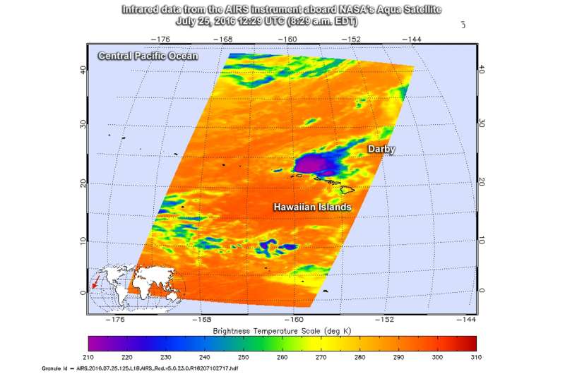
NASA's Aqua satellite passed over Darby at 12:29 UTC (8:29 a.m. EDT) and gathered infrared temperature data on the storm using the Atmospheric Infrared Sounder instrument. Data showed that the coldest cloud top temperatures, in excess of minus 63 degrees Fahrenheit (minus 53 degrees Celsius) and strongest thunderstorms were north of the center, where RapidScat found the strongest winds.
By 0300 UTC on July 26 (11 p.m. EDT, July 25) NOAA's Central Pacific Hurricane Center deemed Darby a post-tropical storm. It was centered about 265 nautical miles west-northwest of Honolulu, Hawaii near 22.6 degrees north latitude and 161.8 degrees west longitude. Darby was moving to the west-northwest at 8 knots (9.2 mph/14.8 kph) and had maximum sustained winds near 25 knots (28.7 mph/46.3 kph).
By 1332 UTC (9:32 a.m. EDT/3:32 a.m. HST) on July 26 the CPHC said the remnants of Darby were located around 250 miles to the west-northwest of Lihue and are expected to dissipate over the next day or two.

Provided by NASA's Goddard Space Flight Center


